How Drones Are Helping To Improve Our Knowledge And Management Of Deer
Share article:
Article by:
Andrea Barden, Marketing & Fundraising Executive, British Deer Society
Guest contribution by:
Katie Harrower, BH Wildlife Consultancy
DRONES ARE GIVING US A NEW INSIGHT ON DEER ACROSS THE UK
Counting (surveying) deer has never been a simple task, yet it is of vital importance when it comes to understanding the UK’s deer populations and for ensuring their management is done humanely, effectively and sustainably.
See: Why Manage Deer?
Modern technology, primarily in the form of drones and camera traps are providing us with new insights on deer numbers and population metrics, such as the number of males and females, at a level of accuracy we’ve never had before.
Katie and Ben Harrower, from BH Wildlife Consultancy explain below how drone technology is being used to census wildlife populations and deer populations for the benefit of wildlife management and conservation.
USING DRONES TO COUNT (CENSUS) DEER
By Katie Harrower
BH Wildlife Consultancy has been operating for several years but it has only been since 2019 that thermal imaging drone census has become a robust and viable method to count wildlife and is now our main area of work. Drone technology has advanced hugely in recent years with batteries having more capacity which allows longer flight times as well as drone platforms being able to withstand more challenging weather conditions.
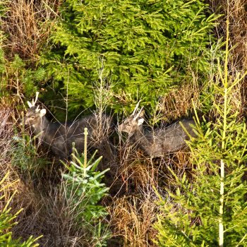
Drones are able to access hard to reach areas and locate deer across a range of habitats, particularly woodland, where other census methods have often struggled. When deer are located, the zoom camera lens can zoom in close enough to identify the species, sex and even in some cases, age class of the deer. The drone doesn’t need to be very close to the deer to be able to see them as the zoom on the camera is very powerful so the majority of the time, we are able to observe them without any disturbance.
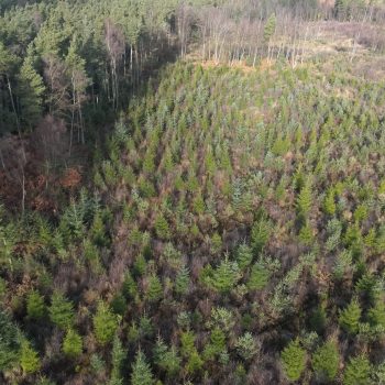
Wide-angle view above a forest.
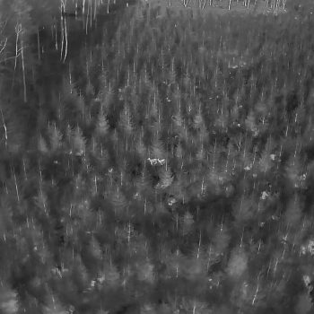
Thermal camera view.
Camera zoom identifies Sika Deer.
Data is collected as quickly as possible in a methodical way, with planning and moving between flight points being crucial for an accurate census. This is done to make the data collected as accurate as possible by avoiding double counting or having deer move in or out the survey area during the count. We often have multiple pilots operating at the same time for some of the bigger jobs for this reason. Land and deer managers are able to attend if the wish to watch the census take place and observe each deer being located.
The data is then able to be turned around very quickly with a base line figure generated straight after the survey and more detailed analysis and a report taking a matter of days. When wildlife management decisions are needing to be made, we understand how important it is to be able to provide the land manager the data quickly with confidence on its accuracy.
We believe drones and associated mapping technology is the future for wildlife monitoring and with the rapid technological advances, we see this method of survey becoming even more efficient in the near future.
